Destination
Ourika Valley from Marrakech by car
The Ourika Valley opens 68 kilometres south of Marrakech, at the end of a road paved all the way to Setti Fatma. River, Berber villages, seven waterfalls and 8 to 10 °C cooler air than the city, 1 h 15 away.
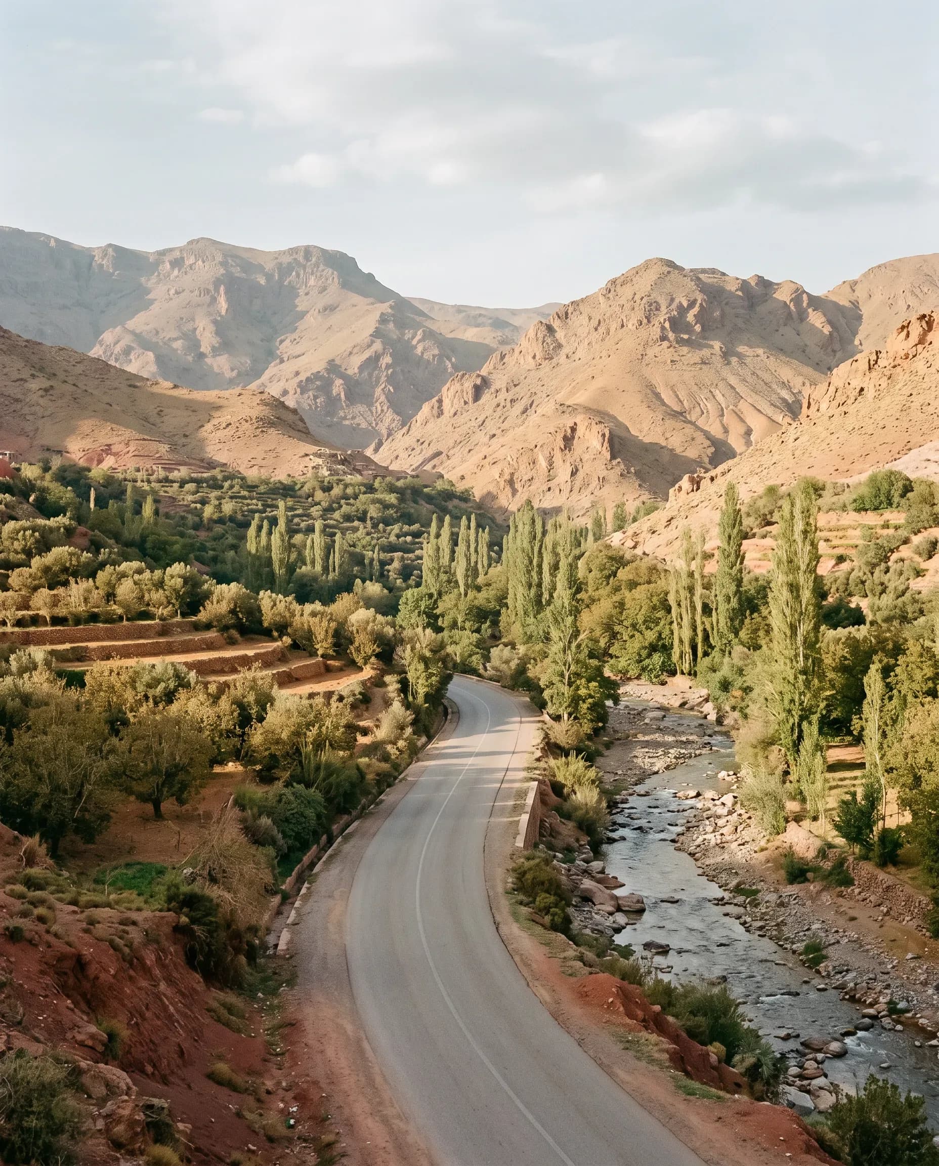
The Ourika Valley lies 68 kilometres south of Marrakech, a 1 hour 15 minute drive on the R2017, paved all the way to Setti Fatma. A saloon car reaches it without difficulty; only the tracks above Setti Fatma toward Oukaïmeden require a 4x4.
The Marrakech — Ourika Valley route in figures
Eight data points recorded on the R2017, from Guéliz to Setti Fatma, altitude and road condition included.
- Distance
- 68 km from Guéliz, via the R2017base
- Drive time
- 1 h 15 driving, longer on Sunday afternoons in summerbase
- Road surface
- Tarmac for the full 68 km to Setti Fatmalocal
- Road condition
- Frequent potholes past Tnine Ourika (35 km)LCM
- Altitude
- From 450 m in Marrakech to 1,500 m in Setti Fatmalocal
- Vehicle required
- Saloon as far as Setti Fatma, 4x4 beyond toward Oukaïmedenbase
- Road closures
- R2017 closed by the authorities during flash floods, March–Maylocal
- Track included
- Oukaïmeden track included at no extra cost in our 4x4 contractsLCM
What is the route from Marrakech to the Ourika Valley?
The route follows the R2017 for 68 kilometres, paved throughout from Marrakech to Setti Fatma. The road passes through Tnine Ourika at kilometre 35, then Aghbalou at kilometre 52, following the Ourika river the entire way.
Leave Marrakech on the Ourika road, heading southeast toward Tnine Ourika. The surface is wide and recently resurfaced for the first 35 kilometres, with two clear lanes and few bends. Tnine Ourika hosts a souk every Monday, the valley's main weekly market.
The road deteriorates past Tnine Ourika: potholes appear across several stretches as far as Aghbalou, at kilometre 52. The tarmac stays continuous to Setti Fatma, at kilometre 68, where the paved road stops abruptly at the edge of the riverbed.
- Leave Marrakech early in the morning to avoid Sunday traffic.
- Slow down past Tnine Ourika, where the road surface deteriorates in places.
- Follow the Ourika river, visible from the road for most of the drive.
- Park the vehicle in Setti Fatma, where the paved road ends.
Which vehicle suits the Ourika Valley from Marrakech?
A saloon car reaches Setti Fatma without difficulty over the 68 paved kilometres of the R2017. A 4x4 becomes necessary only for the tracks above Setti Fatma, toward the Oukaïmeden ski resort, at 2,600 metres altitude.
The R2017 stays paved for the entire drive to Setti Fatma. An Audi or a Mercedes covers the 68 kilometres without leaving tarmac, despite the potholes reported past Tnine Ourika.
Beyond Setti Fatma, the tracks toward Oukaïmeden climb to 2,600 metres over 6 further kilometres. A Range Rover or another 4x4 clears this section without risking the underbody, which a saloon car cannot do.
- Audi luxury car rental in Marrakecha saloon suited to the paved R2017
- Mercedes luxury car rental in Marrakechcomfort over the 68 km to Setti Fatma
- 4x4 & SUV rental in Marrakechneeded for the tracks above Setti Fatma
- Range Rover rental in Marrakechfor reaching Oukaïmeden at 2,600 m
What is there to see and do in the Ourika Valley?
The Ourika Valley unfolds in three stages from Marrakech: Tnine Ourika with its Monday souk, Aghbalou beside the river, and Setti Fatma, the starting point for the valley's seven waterfalls, reached after a 45-minute walk above the village.
Tnine Ourika, at kilometre 35, hosts the valley's main weekly souk every Monday. Residents from neighbouring villages sell vegetables, rugs and argan oil there. Aghbalou, at kilometre 52, runs directly alongside the Ourika river and holds several riverside terraces.
Setti Fatma, at kilometre 68, marks the end of the tarmac. A marked trail climbs from the village to the seven waterfalls of the Ourika, in 45 minutes on foot. The upper waterfalls require 30 further minutes and a steeper passage.
- Visit the Tnine Ourika souk, every Monday, 35 kilometres from Marrakech.
- Have lunch on a riverside terrace in Aghbalou.
- Walk 45 minutes from Setti Fatma to the seven waterfalls.
- Photograph the almond blossom between late February and mid-March.
When to visit the Ourika Valley and what precautions apply?
The Ourika Valley stays 8 to 10 °C cooler than Marrakech, which explains its crowds in July and August. Flash floods hit the Ourika river between March and May: never park a vehicle on the riverbed.
The temperature difference explains the valley's summer popularity. Moroccan authorities close the R2017 when the river level rises, generally between March and May and after summer storms. Flash floods sweep away vehicles and equipment parked on the dry riverbed.
Almond blossom colours the hillsides from late February to mid-March. Snow covers Oukaïmeden from December to March, closing the tracks beyond Setti Fatma to vehicles without a 4x4.
- Avoid parking on the riverbed, even when it looks dry.
- Check the weather forecast before a trip between March and May.
- Pack warm clothing in winter, as altitude reaches 1,500 metres at Setti Fatma.
- Leave early on weekends, as the valley fills by 10 a.m. in summer.
How to plan a day in the Ourika Valley from Marrakech?
Book a saloon for Setti Fatma or a 4x4 for Oukaïmeden, delivered to your hotel or Ménara airport the day before departure. Allow half a day: 2 h 30 of driving round trip and 3 hours on site.
- car rental at Marrakech Ménara airportcollect the vehicle before heading to the Ourika Valley
- chauffeur-driven luxury car rental in Marrakech900 MAD/day if you prefer not to drive the R2017
- luxury car rental rates in Marrakechfull pricing grid by category
- contact and booking with Luxury Car Marrakeshbooking confirmed within 15 minutes
Frequently asked questions about the Ourika Valley from Marrakech
Five questions come up before every trip to the Ourika Valley: whether a saloon can make it, how long to allow on site, the flash-flood risk in spring, access to Oukaïmeden and the best season for almond blossom.
Can a saloon car reach Setti Fatma?
Yes. The R2017 stays paved for the full 68 kilometres between Marrakech and Setti Fatma. An Audi or a Mercedes covers the drive in 1 h 15, with no track and no river crossing. Only the 6 kilometres beyond, toward Oukaïmeden, require a 4x4.
How much time should be allowed for the Ourika Valley?
Allow a full day from Marrakech: 2 h 30 of driving round trip, a 45-minute walk to the waterfalls, and 2 to 3 hours for the villages and riverside meals. A 9 a.m. departure allows a return around 6 p.m.
Is the Ourika road dangerous in the rain?
Yes, in places. The Ourika river causes flash floods between March and May and after summer storms. Moroccan authorities then close the R2017, and a vehicle should never be parked on the riverbed.
Is a 4x4 needed to reach Oukaïmeden from Setti Fatma?
Yes. The track between Setti Fatma and Oukaïmeden climbs to 2,600 metres over 6 unpaved kilometres. A Range Rover or another 4x4 clears this section; a saloon stops at Setti Fatma, the last paved point, 68 kilometres from Marrakech.
When does the almond blossom appear in the Ourika Valley?
Almond blossom lasts from late February to mid-March on the hillsides between Tnine Ourika and Aghbalou. This period comes before the summer high season and brings temperatures close to 20 °C, ideal for the walk to the Setti Fatma waterfalls.
Other routes and vehicles
Other destinations
- destinations and excursions from Marrakech
Every route covered, from Agafay to Ouarzazate.
- Agafay desert by luxury car from Marrakech
30 km, including 6 km of track.
- Ouarzazate and valleys from Marrakech by car
196 km over the Tichka pass.
Vehicles for the Ourika Valley
- 4x4 & SUV rental in Marrakech
for the Oukaïmeden tracks.
- Range Rover rental in Marrakech
Sport, Evoque and Cullinan.
- Audi luxury car rental in Marrakech
a comfortable saloon for the R2017.
- Mercedes luxury car rental in Marrakech
saloon from 1,800 MAD/day.
Before you leave
- car rental at Marrakech Ménara airport
collection straight from Ménara.
- chauffeur-driven luxury car rental in Marrakech
900 MAD/day, 10 hours.
- driving in Marrakech: rules and advice
speed limits, radars, road condition.
- luxury car rental rates in Marrakech
full pricing grid by category.
- contact and booking with Luxury Car Marrakesh
confirmation within 15 minutes.
Luxury Car Marrakesh rents the saloons and 4x4s used to reach the Ourika Valley from Marrakech, Morocco. Vehicles are delivered free of charge to Marrakech-Ménara airport, to hotels in Guéliz and Hivernage, and to riads in the Medina, with the Oukaïmeden track authorised under contract for 4x4 models.